Turkey Geographic Heat Map Generator Excel Template
Unique Excel Template to create Turkey Heat Map. Just put your data and your printable density map will be generated automatically.

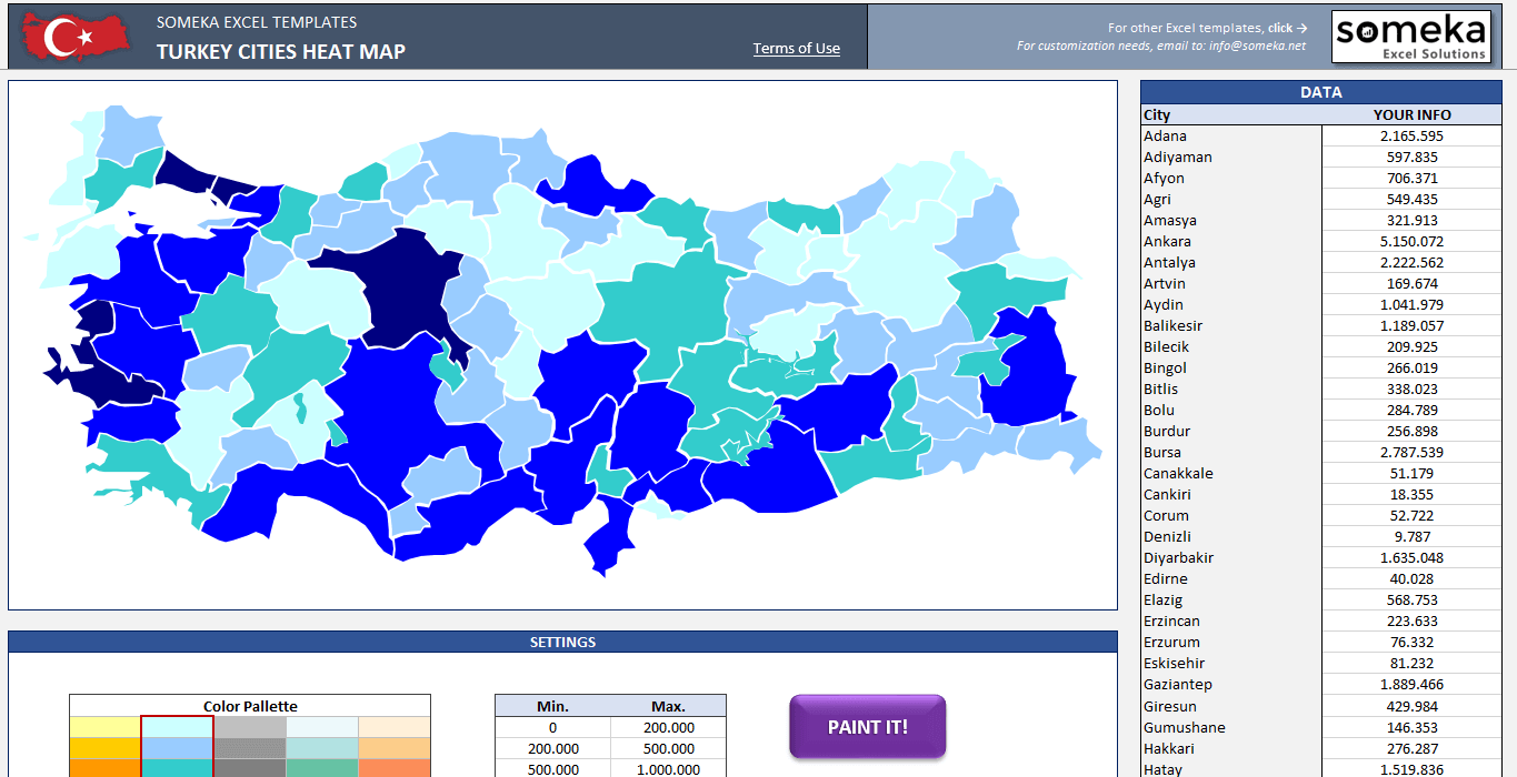
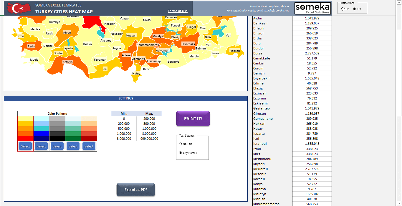
TEMPLATE DESCRIPTION
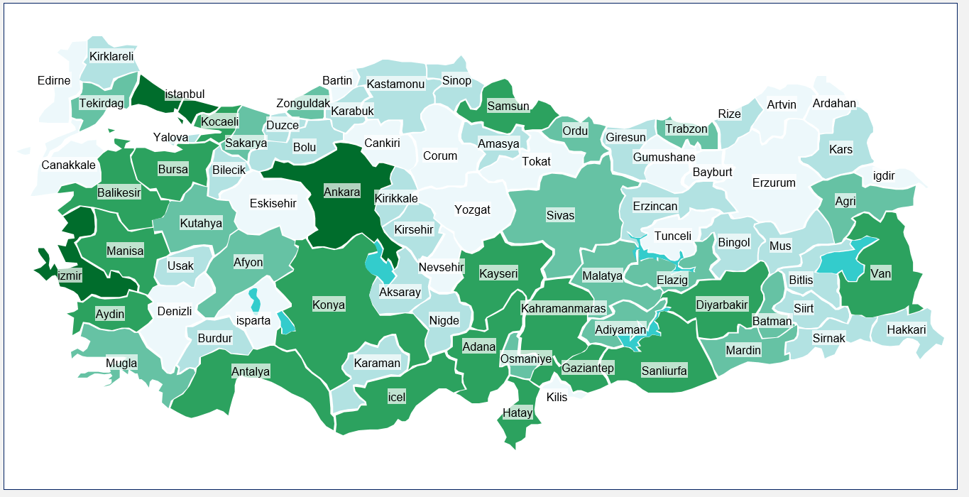
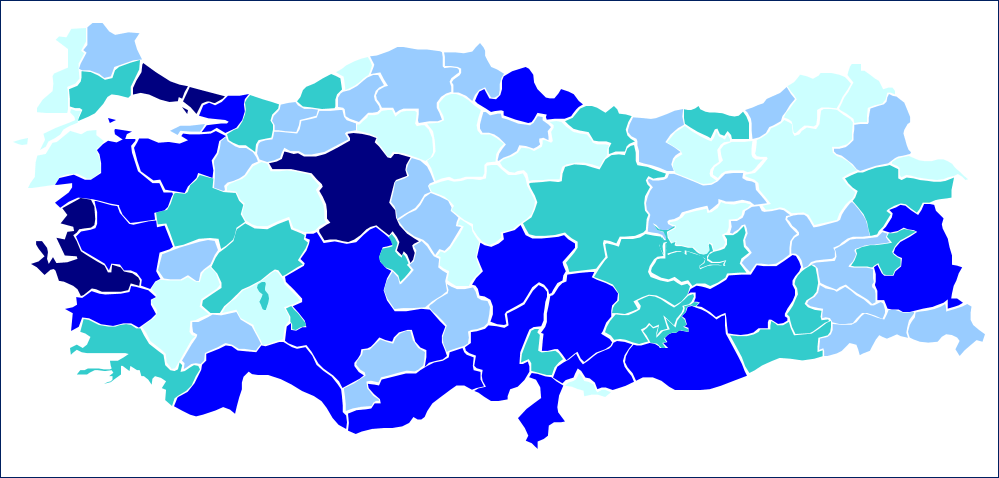
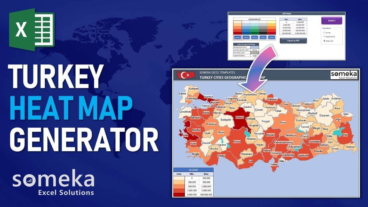
Heat maps are a great way to visualize your data sets. You can use geo heat maps on your presentations, reports, and analysis to make it easier to understand the data distribution on maps. For example, Turkey Heat Map of cities by population would look like this:
However, preparing a geographic heat map is not as easy as it sounds. We have prepared Turkey Cities Heat Map Generator to make the preparation process much smoother and faster.
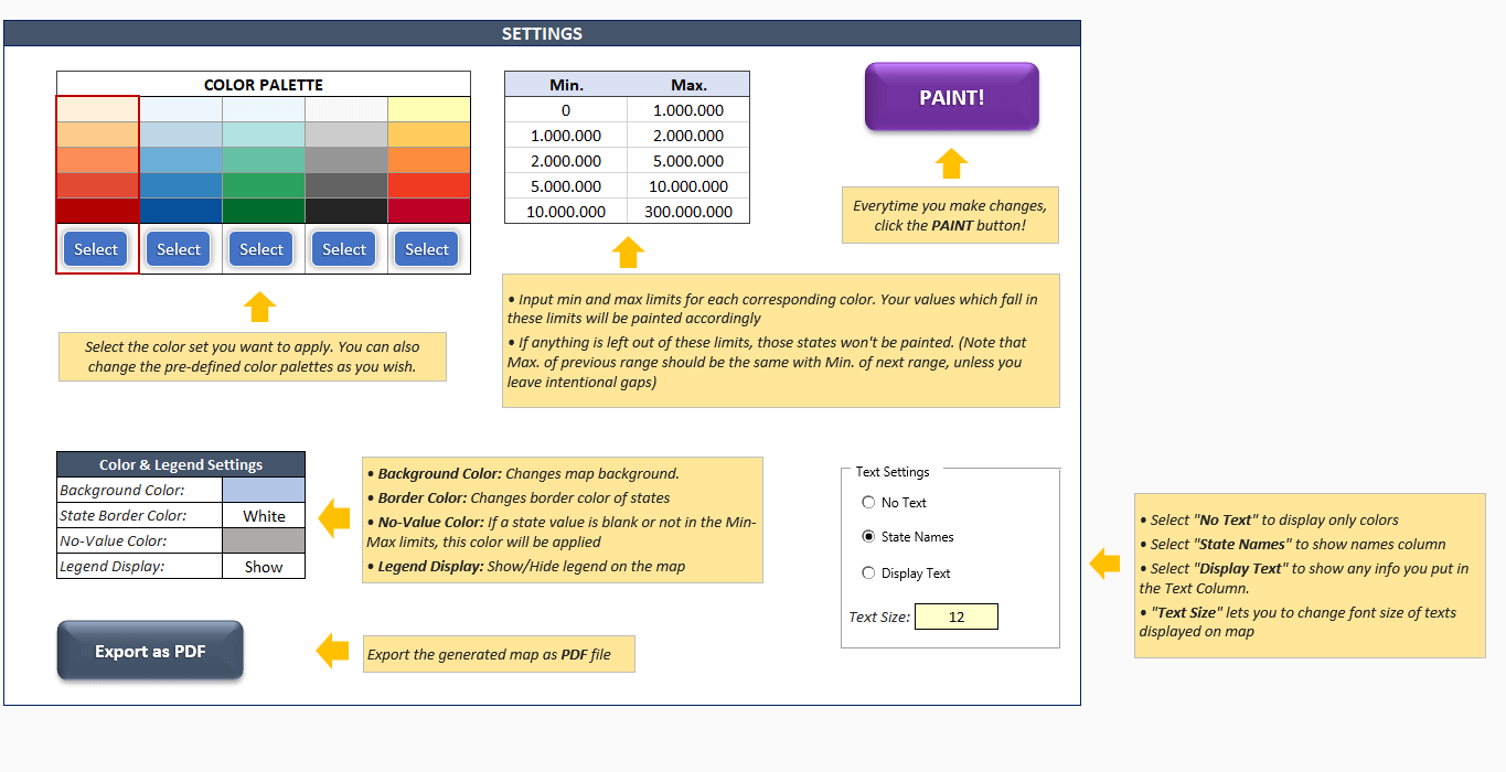
PREPARE YOUR HEAT MAP IN 3 STEPS:
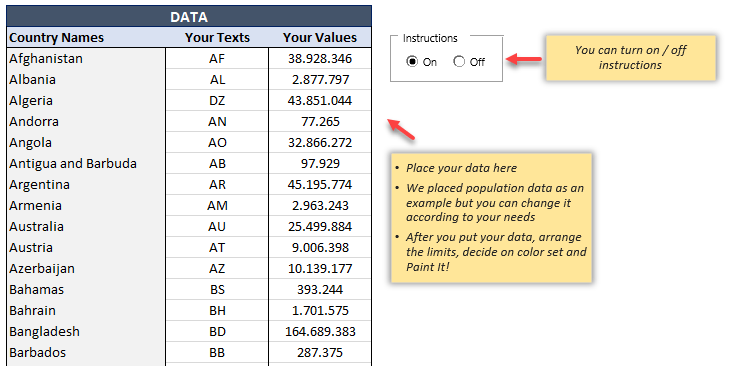
1) Put your data according to the cities
2) Define your color limits
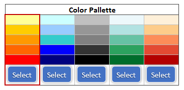
3) Choose a color palette
Now you can create a Turkey choropleth map in a few minutes!
Above all, on-sheet instructions will guide you about the usage of the template:
Since it’s print-ready, you can easily print it. In addition, you can easily export it to PDF if you like.
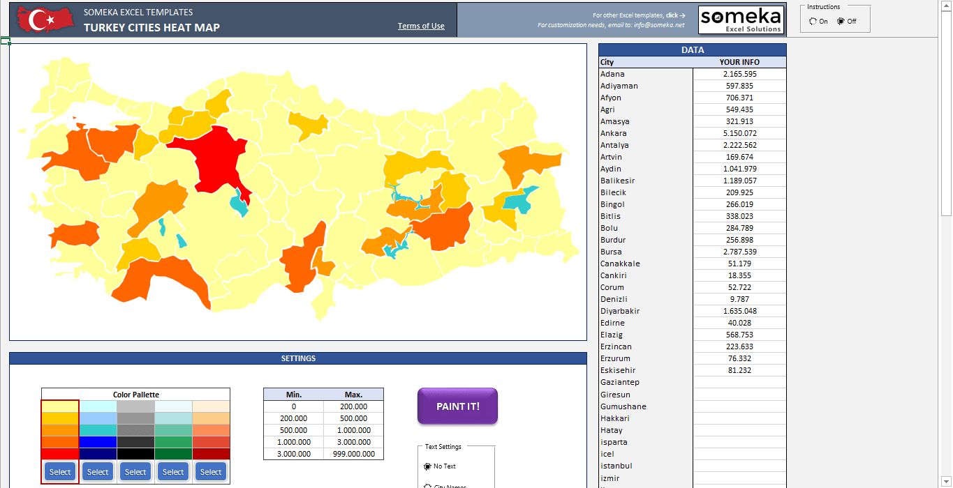
To clarify, you can pick one of 5 different color set options or change the colors as you wish:
Finally, we would like to remind you of other continent and country heat map generators which are available at:
Someka Heat Maps Collection
Turkey Heat Map Generator Features Summary:
- Fully editable Turkey Cities map with also 81 cities
- Easy to use and nice density map
- 5 Premade color sets to choose from (you can even modify as you wish)
- Export to PDF feature
- Clear on sheet instructions (with turn on/off function)
- Print Ready
- No installation needed, ready-to-use
- Works both on Mac and Windows
- Compatible with Excel 2007 and later versions
- Includes VBA codes and macros
PRODUCT VIDEO
Watch the video below to see the template in action! Presentation also includes usage notes, explanations and tips & tricks about the template.
USER REVIEWS & COMMENTS
2 reviews for Turkey Geographic Heat Map Generator Excel Template
You must be logged in to post a review.
RELATED TEMPLATES
-
 This product has multiple variants. The options may be chosen on the product page
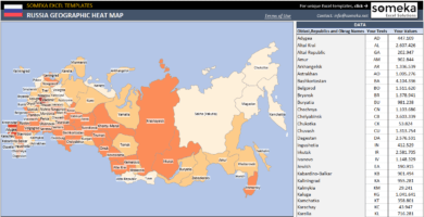
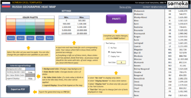
Russia Geographic Heat Map Generator Excel Template
$9.95 – $19.95Excel spreadsheet to create Russia Heat Map. Visualize your data on a density map automatically. Editable shapes compatible with Powerpoint.
-
This product has multiple variants. The options may be chosen on the product page
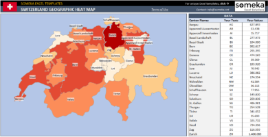
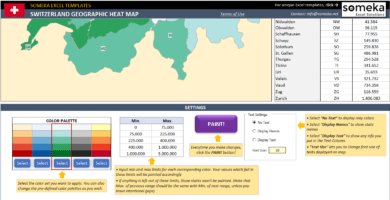
Switzerland Geographic Heat Map Generator Excel Template
$9.95 – $19.95Automated Excel template to create Heat Map of Switzerland with a button click. Enter your own data and specify the colors. Compatible with Powerpoint.
-
This product has multiple variants. The options may be chosen on the product page
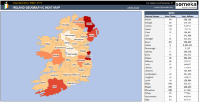
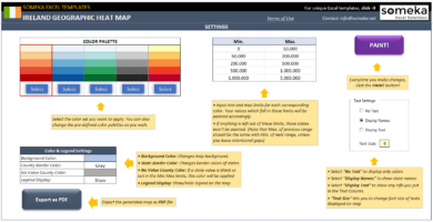
Ireland Geographic Heat Map Generator Excel Template
$29.95 – $59.95Spreadsheet template to create Ireland Counties Heat Map. Transform your numbers and geographical data into a map chart in Excel!
-
This product has multiple variants. The options may be chosen on the product page
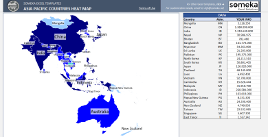
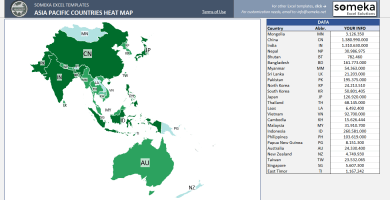
Asia Pacific Heat Map Generator Excel Template
$9.95 – $19.95Printable Geographic Heat Map of Asia Pacific Countries. Just put your data in Excel and your APAC heat map will be generated automatically!
-
This product has multiple variants. The options may be chosen on the product page
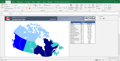
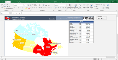
Canada Geographic Heat Map Generator Excel Template
$29.95 – $59.95This Canada Heat Map Excel Template automatically generates colored states according to your data. Just put your values and it will create the heat map.
-
This product has multiple variants. The options may be chosen on the product page
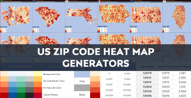
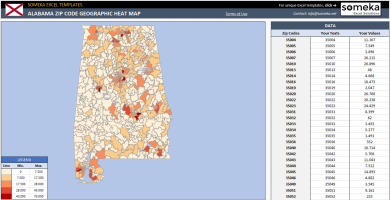
US Zip Code Heat Map Generator Excel Templates
$39.95 – $79.95US Zip Code Heat Map Generators convert your data into visual geographical heat map by zip code. Editable shapes in Excel & Powerpoint.
Cumhur İnal –
can you help? i payed for it but it’s not working.
Someka –
Hi Cumhur, after downloading your product, you will need to unzip the folder. Once you have opened your Excel file, make sure that you have enabled the macros so that your template will be ready to use. If you wish to make any changes, please remember to unlock your sheets first. You will find your password included in your zip file.
Derya Onat Wallace –
simple to use and looks really cool.