Africa Heat Map Generator Excel Template
Unique Excel Template to generate Africa Heat Map. Just put your data and your printable Geographic Heat Map will be generated automatically.
TEMPLATE DESCRIPTION
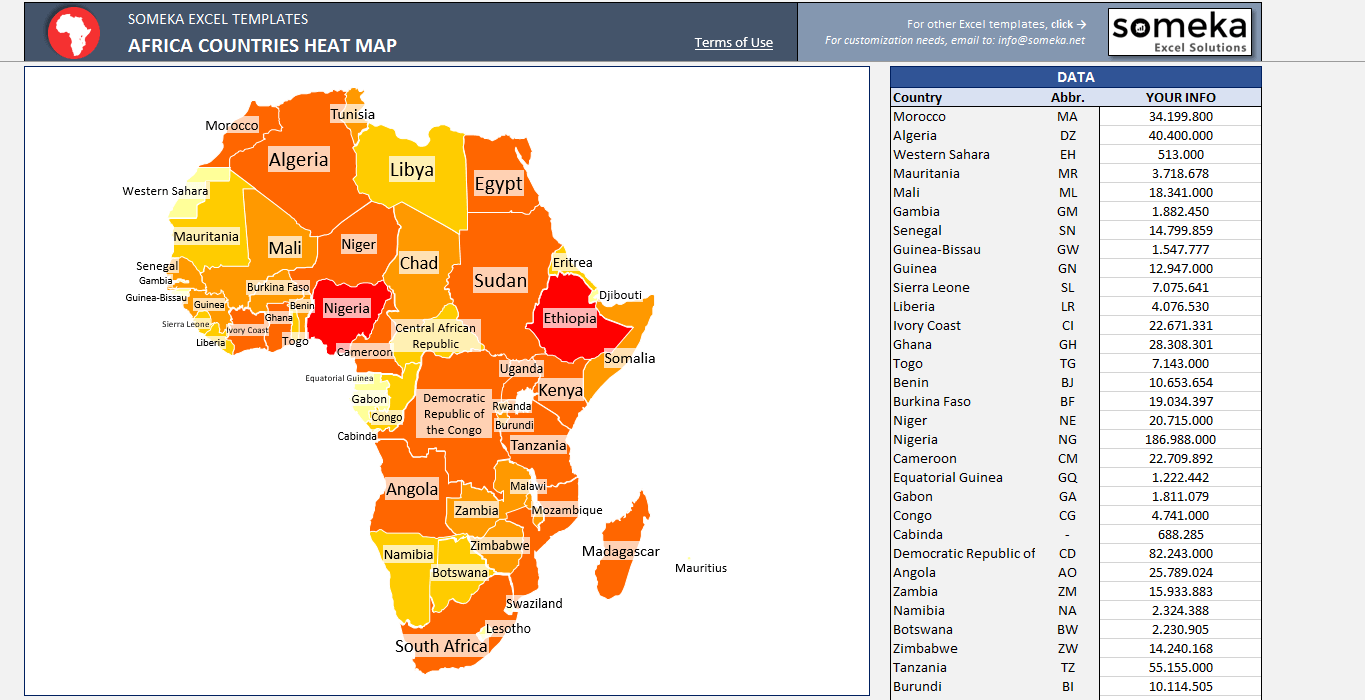
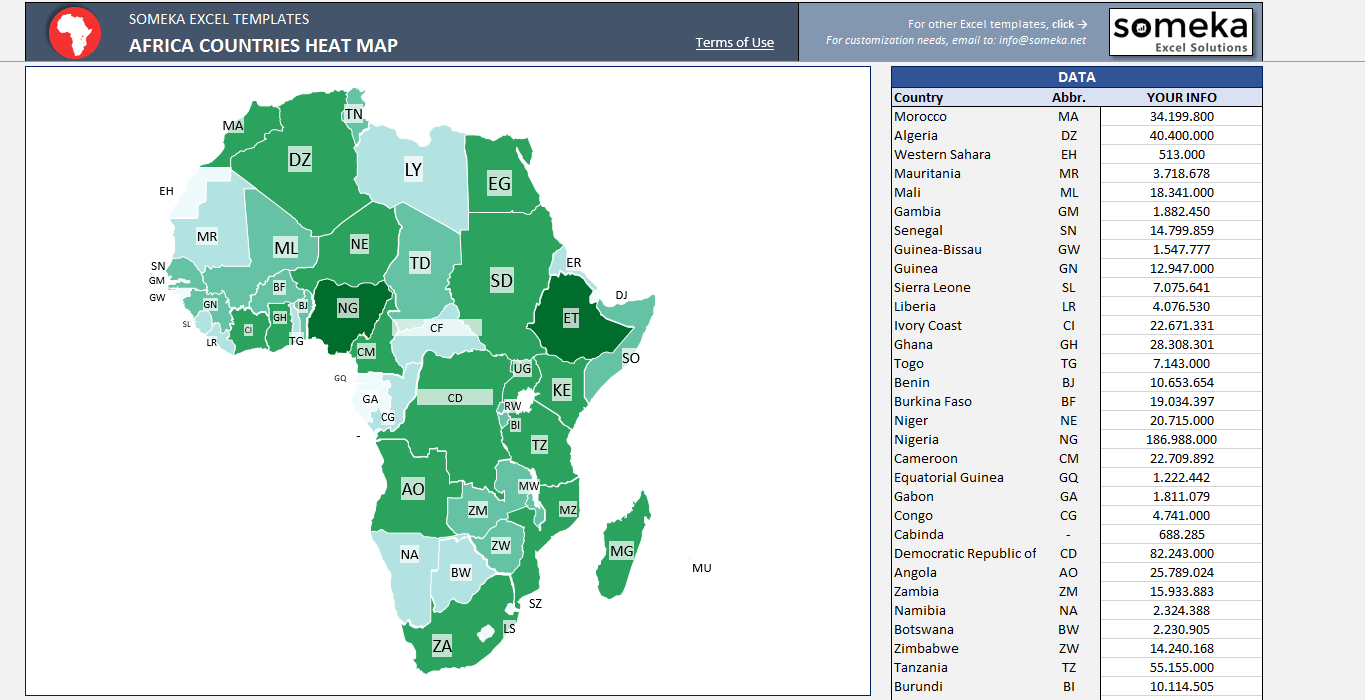
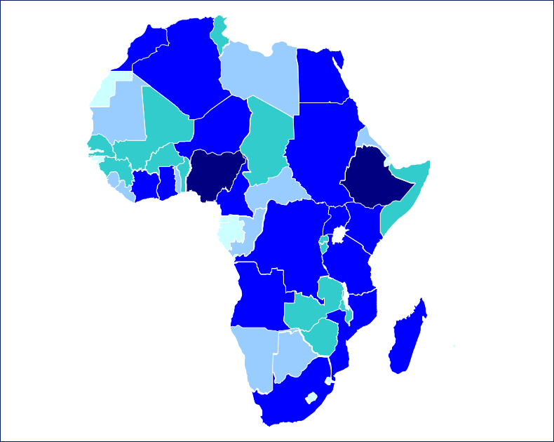
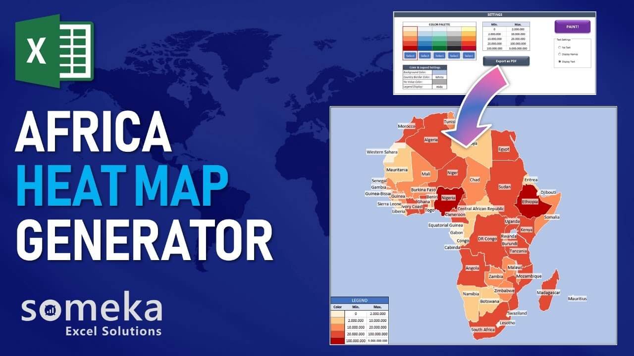
We use geographic heat maps in order to represent quantitative data points with the help of color sets. It is an efficient data visualization method. Many professions like meteorology, sociology, politics, economics, and so on usually use heat maps in order to visualize a data set. For example, you can use an Africa Heat Map Generator which would create a map like this:
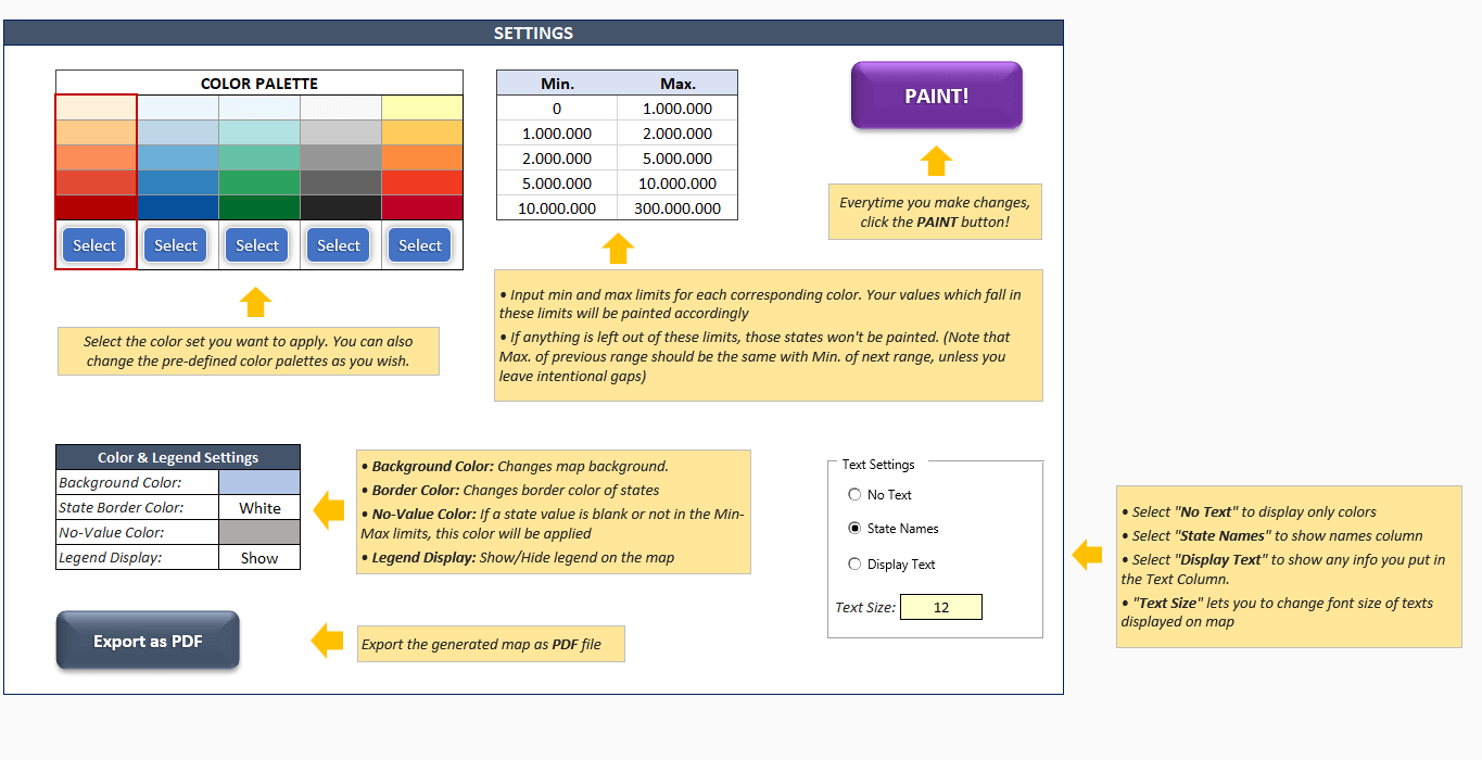
On the other hand, it is not easy to create a density map from scratch. It will be probably better to prefer a pre-made one. Someka Africa Continent Geographic Heat Map Template provides you to turn your data into an interactive map in Excel, in 3 basic steps:
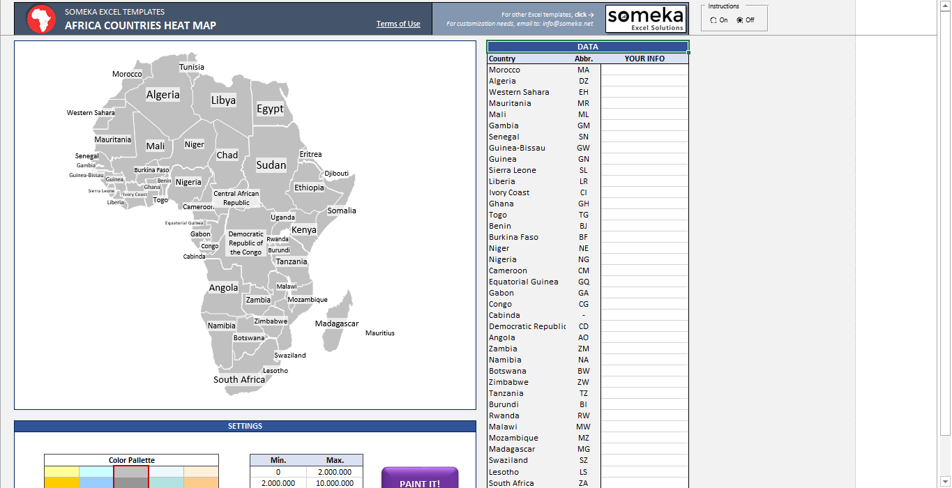
1. Step: Paste/Type your data set from your own spreadsheet
2. Step: Choose your data ranges
3. Step: Choose your color set
Your heat map is ready within a few minutes!
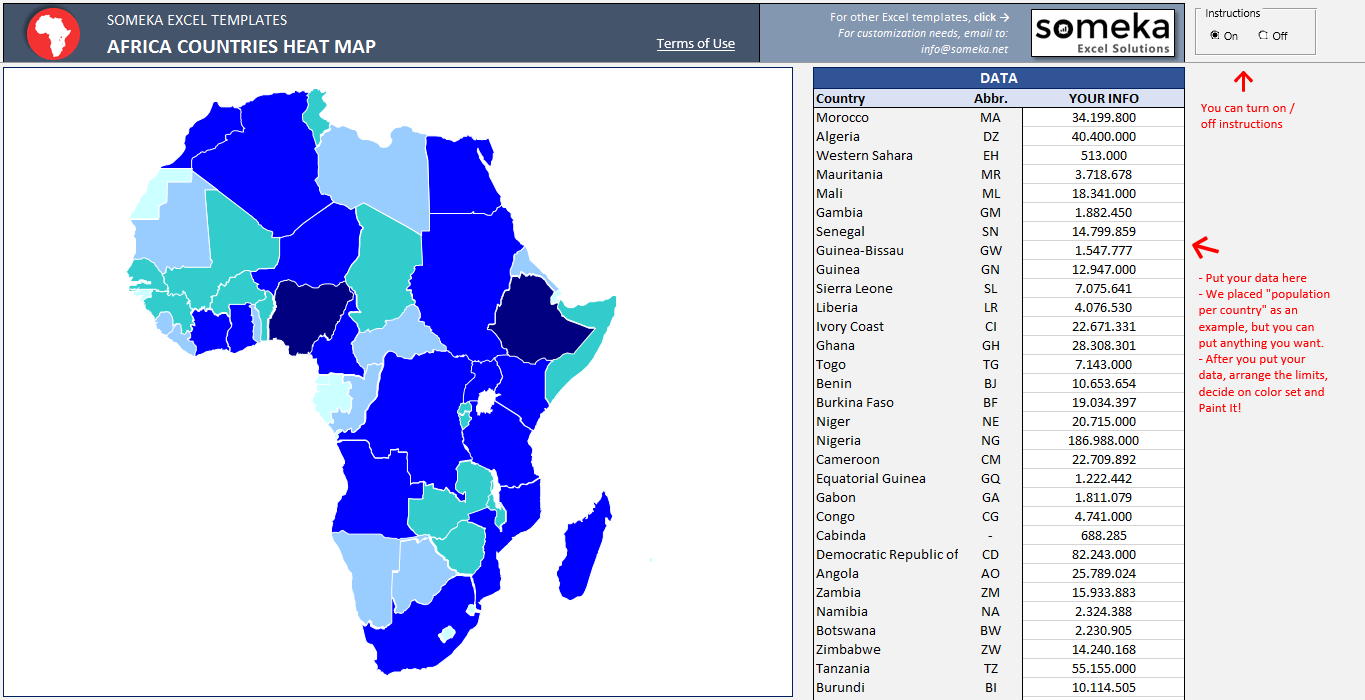
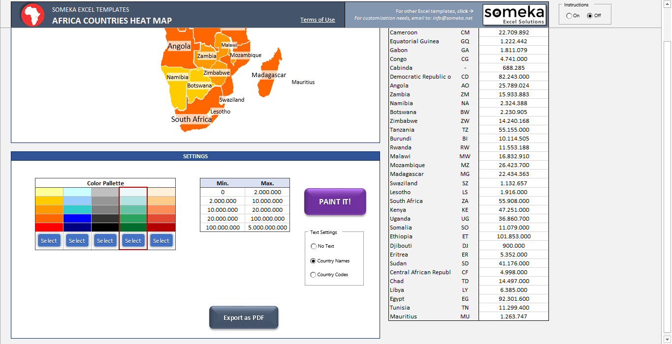
TURN YOUR SPREADSHEET INTO A HEAT MAP!
On-sheet instructions will guide you clearly on how to use them. In addition, you will enormously save time by using a pre-made template. You will see that, it’s pretty easy to put your data in and get the choropleth map generated automatically:
Since it’s print-ready, you can easily print it. Moreover, you can easily export it to PDF if you like.
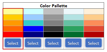
Furthermore, we offer 5 pre-made color sets to choose from, you can even modify these color sets, as you wish:
Finally, we would like to remind you of other continent and country heat map generators which are available at:
Someka Heat Maps Collection
Africa Heat Map Generator Features Summary:
- Fully editable map of Africa with also 59 countries
- Easy to use and nice design
- 5 Premade color sets to choose from (you can even modify as you wish)
- Export to PDF feature
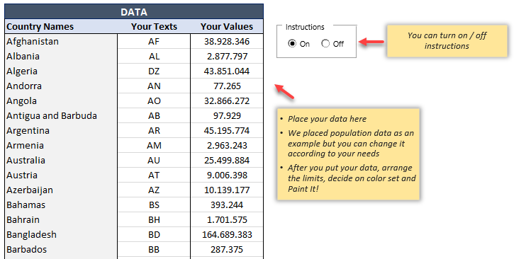
- Clear on sheet instructions (with turn on/off function)
- Print Ready
- No installation needed, ready-to-use
- Works both on Mac and Windows
- Compatible with Excel 2007 and later versions
- Includes VBA codes and macros
PRODUCT VIDEO
Watch the video below to see the template in action! Presentation also includes usage notes, explanations and tips & tricks about the template.
USER REVIEWS & COMMENTS
11 reviews for Africa Heat Map Generator Excel Template
You must be logged in to post a review.
RELATED TEMPLATES
-
 This product has multiple variants. The options may be chosen on the product page
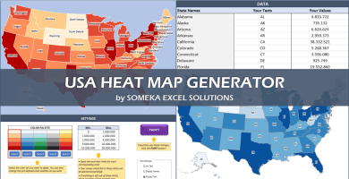
US Geographic Heat Map Generator Excel Template
$0.00 – $79.95Easy to use Heat Map Excel Template for US states. Just put your data and your printable Geographic Heat Map will be generated automatically.
-
This product has multiple variants. The options may be chosen on the product page
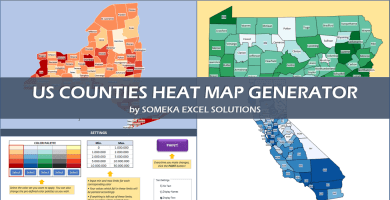
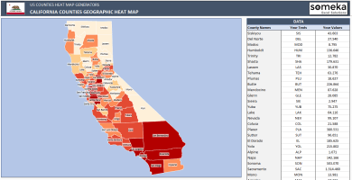
US County Heat Map Generator Excel Templates
$0.00 – $79.95Excel Template to generate heat maps for US Counties. Visualize your data in an editable spreadsheet. Copy paste shapes into Powerpoint.
-
This product has multiple variants. The options may be chosen on the product page
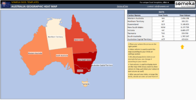
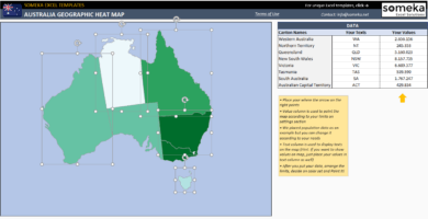
Australia Geographic Heat Map Generator Excel Template
$0.00 – $59.95Dynamic Excel spreadsheet to create Australia Heat Map. Paint states automatically according to your data. Editable shapes compatible with Powerpoint.
-
This product has multiple variants. The options may be chosen on the product page
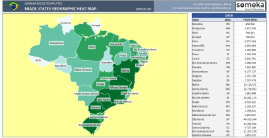
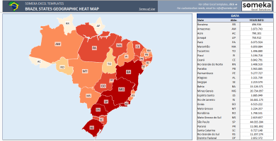
Brazil Geographic Heat Map Generator Excel Template
$0.00 – $59.95Unique Excel Template to create Brazil Heat Map instantly. Enter your own data and Brazil states get painted automatically with VBA.
-
This product has multiple variants. The options may be chosen on the product page
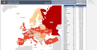
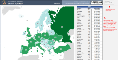
Europe Geographic Heat Map Generator Excel Template
$0.00 – $59.95Europe Heat Map Excel Template for Europe countries. Just put your data, set your colors and create Heat Map of Europe in seconds!
-
This product has multiple variants. The options may be chosen on the product page
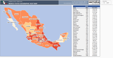
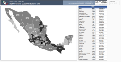
Mexico Geographic Heat Map Generator Excel Template
$0.00 – $59.95Dynamic Excel Template to create Mexico Heat Map automatically at state level. Enter your data in the template and heat map gets ready instantly.

Neguar Wesmhchea –
Thanks to this new subscription system, trying new Someka templates is now possible.
AbeniFuraha –
I added my data but my map did not update., please help!
Someka –
Hi Abeni, After inputting your data and stating your legend criteria for each color -by defining their maximum and minimum values-, you need to click the “Paint” button. Your map will be ready!
Farida Ali –
good job
Youssef Kumar –
Nice template. But is it possible to show two different data (for the same location) on the same map?
Someka –
Hi Youssef, Unfortunately one map can’t include two different data, you can show only one data on the map. Hope this helps.
Dylan A –
hello someka!
love this app.
can I share it with my team member?? I have su
Someka –
Hello Dylan,
About our license details, our single-user license is for personal use only. With the multi-use license, you will have the right to share the file with your colleagues in the same organization and/or put your file on your company’s network for internal use.
But you will still not be allowed to put it on websites with public access or re-sell them or share them with third parties.
We may surely upgrade your license from single-user to multi-user. Just email us at contact@someka.net and our team will contact you with a link to upgrade your license.
Coleen –
PDF button is cool!
Penelope –
thanks for the free version option. I tried and then purchased. You are great team!
Irene –
Hello,
I have to agree with Elias. I study sociology and cannot possibly use this map unless South Sudan is identified as a country. The country has been independent since 2011 and the wars that led to independence are so relevant for the whole region of sub-Saharan Africa that it would be negligent to use the map as it looks right now in academic lectures.
Someka –
Hi Irene,
Thanks a lot for your interest and the time you spare to write your thoughts!
We informed our development team regarding this topic. They will be interested in that topic in the future days.
karan –
I purchased this heat map for my presentation. I watched the product video and found that it is very easy to move shapes to ppt. It helped me improve my presentation visuals. thanks a lot.
Elias –
Hello,
Please split Sudan from South Sudan, they are now two countries and you have presented them as one country making it difficult for us to do our analysis.
Someka –
Hi Elias,
Thanks a lot for your feedback! We will inform our development team about this topic to consider when we decided to update the template.
Regards,
Don –
Hello,
I like your African heat map. Do you have the same for other countries? I’m thinking as a separate African countries like the DRCongo, Zambia, etc. If so, how much does it cost to get a template?
Thank you.
Someka –
Hi Don,
Thanks a lot for your interest!
This is the only heat Map that we have for African countries.
If you want to create a totally separate heat map for Zambia or DRCongo, you can apply our customization process. Excel Rescue is our development partner and once you decide to apply the customization process, they will let you know about the customization.
Otherwise, we are not planning to create any separate Heat Maps for African Countries separately for now.
If you have further questions please do not hesitate to contact us.
Best regards,