

The US state North Carolina (NC) is the 9th largest state by population and 28th biggest state by area. North Carolina has 100 counties ranking it the 8th state with the most counties in USA. See below some basic information about the state:
| Country: | United States |
| State: | North Carolina |
| Abbreviation: | NC |
| Capital: | Raleigh |
| Largest City: | Charlotte |
| Population: | 10,488,084 |
| Population rank in US: | 9th |
| Total Area [mi²]: | 53,819 |
| Total Area [km²]: | 139,390 |
| Area rank in US: | 28th |
| Number of Counties: | 100 |
If you want to show data distributon per geographical area, density maps (or heat maps) are a great way to achieve this. For example, here is a North Carolina Population Density Map per County:
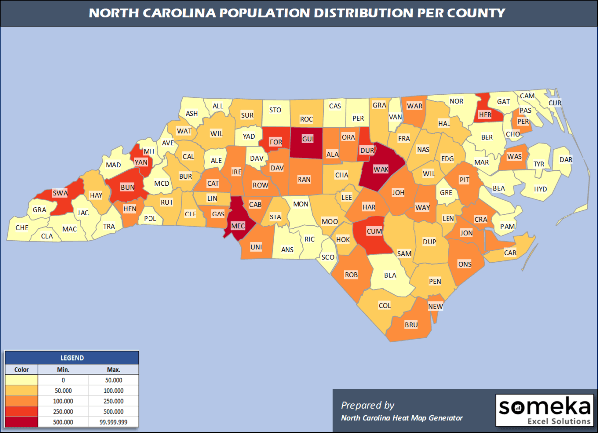
We have prepared this easily with North Carolina County Heat Map Generator for population info. But it can also be used for many different data types such as employment rate, average temperature, racial distribution and so on.
Below are 100 North Carolina counties ranked by population information. The data is from the US Census Bureau. You can copy and paste this list directly into your spreadsheet.
(Top 10 counties shown. To expand the list, simply click on the “show more” button)
| Rank | County | Population |
|---|---|---|
| 1 | Wake County | 1,111,761 |
| 2 | Mecklenburg County | 1,110,356 |
| 3 | Guilford County | 537,174 |
| 4 | Forsyth County | 382,295 |
| 5 | Cumberland County | 335,509 |
| 6 | Durham County | 321,488 |
| 7 | Buncombe County | 261,191 |
| 8 | Union County | 239,859 |
| 9 | New Hanover County | 234,473 |
| 10 | Gaston County | 224,529 |
| 11 | Cabarrus County | 216,453 |
| 12 | Johnston County | 209,339 |
| 13 | Onslow County | 197,938 |
| 14 | Iredell County | 181,806 |
| 15 | Pitt County | 180,742 |
| 16 | Alamance County | 169,509 |
| 17 | Davidson County | 167,609 |
| 18 | Catawba County | 159,551 |
| 19 | Orange County | 148,476 |
| 20 | Randolph County | 143,667 |
| 21 | Brunswick County | 142,820 |
| 22 | Rowan County | 142,088 |
| 23 | Harnett County | 135,976 |
| 24 | Robeson County | 130,625 |
| 25 | Wayne County | 123,131 |
| 26 | Henderson County | 117,417 |
| 27 | Craven County | 102,139 |
| 28 | Moore County | 100,880 |
| 29 | Cleveland County | 97,947 |
| 30 | Nash County | 94,298 |
| 31 | Rockingham County | 91,010 |
| 32 | Burke County | 90,485 |
| 33 | Lincoln County | 86,111 |
| 34 | Caldwell County | 82,178 |
| 35 | Wilson County | 81,801 |
| 36 | Chatham County | 74,470 |
| 37 | Surry County | 71,783 |
| 38 | Franklin County | 69,685 |
| 39 | Carteret County | 69,473 |
| 40 | Wilkes County | 68,412 |
| 41 | Rutherford County | 67,029 |
| 42 | Sampson County | 63,531 |
| 43 | Pender County | 63,060 |
| 44 | Stanly County | 62,806 |
| 45 | Haywood County | 62,317 |
| 46 | Lee County | 61,779 |
| 47 | Granville County | 60,443 |
| 48 | Duplin County | 58,741 |
| 49 | Watauga County | 56,177 |
| 50 | Lenoir County | 55,949 |
| 51 | Columbus County | 55,508 |
| 52 | Hoke County | 55,234 |
| 53 | Edgecombe County | 51,472 |
| 54 | Halifax County | 50,010 |
| 55 | Beaufort County | 46,994 |
| 56 | McDowell County | 45,756 |
| 57 | Stokes County | 45,591 |
| 58 | Richmond County | 44,829 |
| 59 | Vance County | 44,535 |
| 60 | Jackson County | 43,938 |
| 61 | Davie County | 42,846 |
| 62 | Pasquotank County | 39,824 |
| 63 | Person County | 39,490 |
| 64 | Yadkin County | 37,667 |
| 65 | Alexander County | 37,497 |
| 66 | Dare County | 37,009 |
| 67 | Macon County | 35,858 |
| 68 | Scotland County | 34,823 |
| 69 | Transylvania County | 34,385 |
| 70 | Bladen County | 32,722 |
| 71 | Cherokee County | 28,612 |
| 72 | Currituck County | 27,763 |
| 73 | Ashe County | 27,203 |
| 74 | Montgomery County | 27,173 |
| 75 | Anson County | 24,446 |
| 76 | Hertford County | 23,677 |
| 77 | Caswell County | 22,604 |
| 78 | Martin County | 22,440 |
| 79 | Madison County | 21,755 |
| 80 | Greene County | 21,069 |
| 81 | Polk County | 20,724 |
| 82 | Warren County | 19,731 |
| 83 | Northampton County | 19,483 |
| 84 | Bertie County | 18,947 |
| 85 | Yancey County | 18,069 |
| 86 | Avery County | 17,557 |
| 87 | Mitchell County | 14,964 |
| 88 | Swain County | 14,271 |
| 89 | Chowan County | 13,943 |
| 90 | Perquimans County | 13,463 |
| 91 | Pamlico County | 12,726 |
| 92 | Washington County | 11,580 |
| 93 | Gates County | 11,562 |
| 94 | Clay County | 11,231 |
| 95 | Alleghany County | 11,137 |
| 96 | Camden County | 10,867 |
| 97 | Jones County | 9,419 |
| 98 | Graham County | 8,441 |
| 99 | Hyde County | 4,937 |
| 100 | Tyrrell County | 4,016 |
Out of the 100 counties in North Carolina, Wake County is the largest by population. Robeson County is the largest by land area.
Tyrrell County is the smallest North Carolina county by population. Clay County is the smallest by size.
In terms of economics and average income level, Orange County is the richest North Carolina county.
Scotland County is the poorest North Carolina county.
We have prepared North Carolina county density map by population as a downloadable PDF.
You can download the PDF for free from the link below:

North Carolina County Density Map PDF
Check the video below to see how we use our North Carolina County Map Excel Template to visualize any data over North Carolina counties.
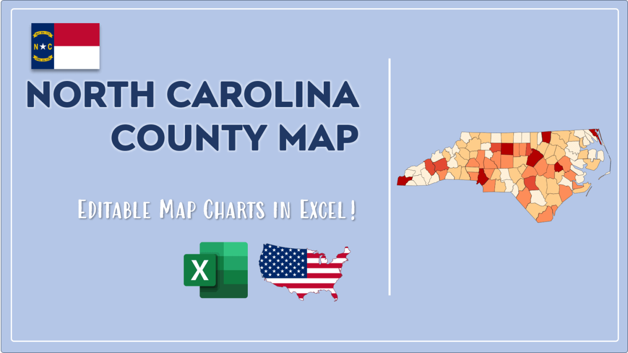
We have built the easiest North Carolina Heat Map Maker in the universe! It works fully in Excel:
Here is a list of useful links which we think can be helpful whether you work on data visualization or make research about North Carolina state and North Carolina counties.
Data Source for Population and many other US related data:
https://www.census.gov
Wikipedia Page for List of North Carolina Counties:
https://en.wikipedia.org/wiki/List_of_counties_in_North_Carolina
Official Website of the State of North Carolina:
https://www.nc.gov
Are you looking for North Carolina Zip Code map?:
North Carolina Zip Code Heat Map Generator in Excel

