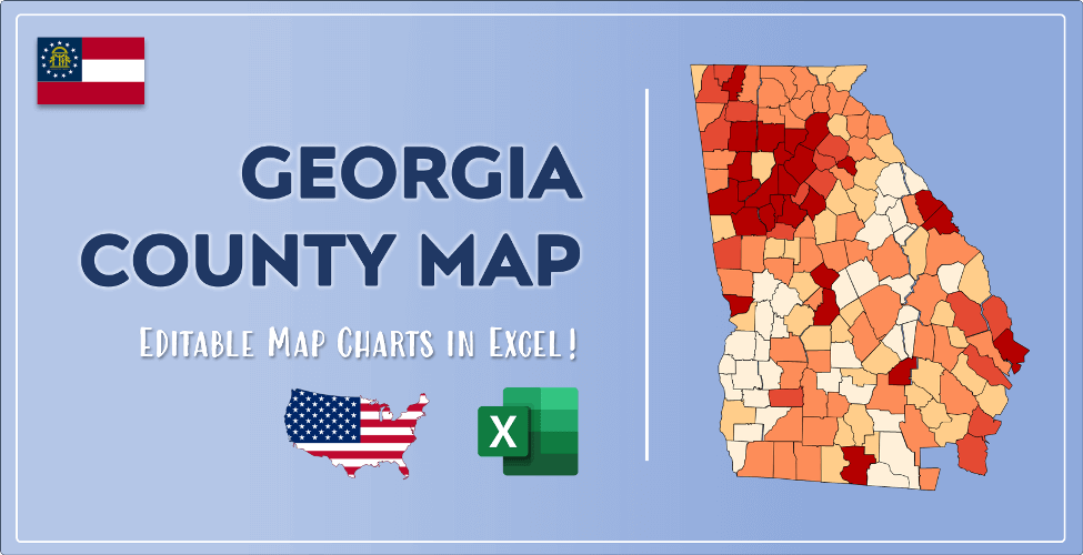

The US state Georgia (GA) is the 8th largest state by population and 24th biggest state by area. Georgia has 159 counties ranking it the 2nd state with the most counties in USA. See below some basic information about the state:
| Country: | United States |
| State: | Georgia |
| Abbreviation: | GA |
| Capital: | Atlanta |
| Largest City: | Atlanta |
| Population: | 10,617,423 |
| Population rank in US: | 8th |
| Total Area [mi²]: | 59,425 |
| Total Area [km²]: | 153,909 |
| Area rank in US: | 24th |
| Number of Counties: | 159 |
If you want to show data distributon per geographical area, density maps (or heat maps) are a great way to achieve this. For example, here is a Georgia Population Density Map per County:
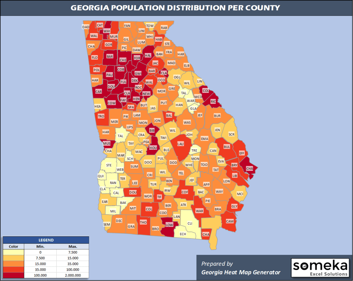
We have prepared this easily with Georgia County Heat Map Generator for population info. But it can also be used for many different data types such as employment rate, average temperature, racial distribution and so on.
Below are 159 Georgia counties ranked by population information. The data is from the US Census Bureau. You can copy and paste this list directly into your spreadsheet.
(Top 10 counties shown. To expand the list, simply click on the “show more” button)
| Rank | County | Population |
|---|---|---|
| 1 | Fulton County | 1,063,937 |
| 2 | Gwinnett County | 936,250 |
| 3 | Cobb County | 760,141 |
| 4 | DeKalb County | 759,297 |
| 5 | Clayton County | 292,256 |
| 6 | Chatham County | 289,430 |
| 7 | Cherokee County | 258,773 |
| 8 | Forsyth County | 244,252 |
| 9 | Henry County | 234,561 |
| 10 | Hall County | 204,441 |
| 11 | Richmond County | 202,518 |
| 12 | Muscogee County | 195,769 |
| 13 | Paulding County | 168,667 |
| 14 | Houston County | 157,863 |
| 15 | Columbia County | 156,714 |
| 16 | Bibb County | 153,159 |
| 17 | Coweta County | 148,509 |
| 18 | Douglas County | 146,343 |
| 19 | Clarke County | 128,331 |
| 20 | Carroll County | 119,992 |
| 21 | Lowndes County | 117,406 |
| 22 | Fayette County | 114,421 |
| 23 | Newton County | 111,744 |
| 24 | Bartow County | 107,738 |
| 25 | Whitfield County | 104,628 |
| 26 | Floyd County | 98,498 |
| 27 | Walton County | 94,593 |
| 28 | Rockdale County | 90,896 |
| 29 | Dougherty County | 87,956 |
| 30 | Glynn County | 85,292 |
| 31 | Barrow County | 83,240 |
| 32 | Bulloch County | 79,608 |
| 33 | Jackson County | 72,977 |
| 34 | Troup County | 69,922 |
| 35 | Walker County | 69,761 |
| 36 | Catoosa County | 67,580 |
| 37 | Spalding County | 66,703 |
| 38 | Effingham County | 64,296 |
| 39 | Liberty County | 61,435 |
| 40 | Gordon County | 57,963 |
| 41 | Camden County | 54,666 |
| 42 | Laurens County | 47,546 |
| 43 | Colquitt County | 45,600 |
| 44 | Habersham County | 45,328 |
| 45 | Baldwin County | 44,890 |
| 46 | Thomas County | 44,451 |
| 47 | Coffee County | 43,273 |
| 48 | Polk County | 42,613 |
| 49 | Tift County | 40,644 |
| 50 | Oconee County | 40,280 |
| 51 | Murray County | 40,096 |
| 52 | Bryan County | 39,627 |
| 53 | Ware County | 35,734 |
| 54 | Harris County | 35,236 |
| 55 | Lumpkin County | 33,610 |
| 56 | Pickens County | 32,591 |
| 57 | Gilmer County | 31,369 |
| 58 | White County | 30,798 |
| 59 | Lee County | 29,992 |
| 60 | Wayne County | 29,927 |
| 61 | Madison County | 29,880 |
| 62 | Haralson County | 29,792 |
| 63 | Sumter County | 29,524 |
| 64 | Jones County | 28,735 |
| 65 | Monroe County | 27,578 |
| 66 | Peach County | 27,546 |
| 67 | Toombs County | 26,830 |
| 68 | Decatur County | 26,404 |
| 69 | Upson County | 26,320 |
| 70 | Hart County | 26,205 |
| 71 | Fannin County | 26,188 |
| 72 | Dawson County | 26,108 |
| 73 | Stephens County | 25,925 |
| 74 | Tattnall County | 25,286 |
| 75 | Butts County | 24,936 |
| 76 | Chattooga County | 24,789 |
| 77 | Grady County | 24,633 |
| 78 | Union County | 24,511 |
| 79 | Franklin County | 23,349 |
| 80 | Emanuel County | 22,646 |
| 81 | Burke County | 22,383 |
| 82 | Crisp County | 22,372 |
| 83 | Putnam County | 22,119 |
| 84 | Mitchell County | 21,863 |
| 85 | McDuffie County | 21,312 |
| 86 | Meriwether County | 21,167 |
| 87 | Dodge County | 20,605 |
| 88 | Washington County | 20,374 |
| 89 | Worth County | 20,247 |
| 90 | Long County | 19,559 |
| 91 | Pierce County | 19,465 |
| 92 | Berrien County | 19,397 |
| 93 | Morgan County | 19,276 |
| 94 | Banks County | 19,234 |
| 95 | Elbert County | 19,194 |
| 96 | Brantley County | 19,109 |
| 97 | Lamar County | 19,077 |
| 98 | Pike County | 18,962 |
| 99 | Appling County | 18,386 |
| 100 | Greene County | 18,324 |
| 101 | Cook County | 17,270 |
| 102 | Rabun County | 17,137 |
| 103 | Ben Hill County | 16,700 |
| 104 | Dade County | 16,116 |
| 105 | Telfair County | 15,860 |
| 106 | Brooks County | 15,457 |
| 107 | Jefferson County | 15,362 |
| 108 | Oglethorpe County | 15,259 |
| 109 | Jeff Davis County | 15,115 |
| 110 | McIntosh County | 14,378 |
| 111 | Jasper County | 14,219 |
| 112 | Screven County | 13,966 |
| 113 | Charlton County | 13,392 |
| 114 | Dooly County | 13,390 |
| 115 | Macon County | 12,947 |
| 116 | Bleckley County | 12,873 |
| 117 | Crawford County | 12,404 |
| 118 | Towns County | 12,037 |
| 119 | Heard County | 11,923 |
| 120 | Bacon County | 11,164 |
| 121 | Pulaski County | 11,137 |
| 122 | Chattahoochee County | 10,907 |
| 123 | Candler County | 10,803 |
| 124 | Evans County | 10,654 |
| 125 | Lanier County | 10,423 |
| 126 | Early County | 10,190 |
| 127 | Wilkes County | 9,777 |
| 128 | Johnson County | 9,643 |
| 129 | Irwin County | 9,416 |
| 130 | Montgomery County | 9,172 |
| 131 | Wilkinson County | 8,954 |
| 132 | Jenkins County | 8,676 |
| 133 | Wilcox County | 8,635 |
| 134 | Terrell County | 8,531 |
| 135 | Hancock County | 8,457 |
| 136 | Marion County | 8,359 |
| 137 | Atkinson County | 8,165 |
| 138 | Twiggs County | 8,120 |
| 139 | Seminole County | 8,090 |
| 140 | Taylor County | 8,020 |
| 141 | Turner County | 7,985 |
| 142 | Lincoln County | 7,921 |
| 143 | Wheeler County | 7,855 |
| 144 | Treutlen County | 6,901 |
| 145 | Randolph County | 6,778 |
| 146 | Stewart County | 6,621 |
| 147 | Clinch County | 6,618 |
| 148 | Talbot County | 6,195 |
| 149 | Calhoun County | 6,189 |
| 150 | Miller County | 5,718 |
| 151 | Schley County | 5,257 |
| 152 | Warren County | 5,254 |
| 153 | Echols County | 4,006 |
| 154 | Baker County | 3,038 |
| 155 | Glascock County | 2,971 |
| 156 | Clay County | 2,834 |
| 157 | Webster County | 2,607 |
| 158 | Quitman County | 2,299 |
| 159 | Taliaferro County | 1,537 |
Out of the 159 counties in Georgia, Fulton County is the largest by population. Ware County is the largest by land area.
Taliaferro County is the smallest Georgia county by population. Clarke County is the smallest by size.
In terms of economics and average income level, Fulton County is the richest Georgia county.
Telfair County is the poorest Georgia county.
We have prepared Georgia county density map by population as a downloadable PDF.
You can download the PDF for free from the link below:

Georgia County Density Map PDF
Check the video below to see how we use our Georgia County Map Excel Template to visualize any data over Georgia counties.
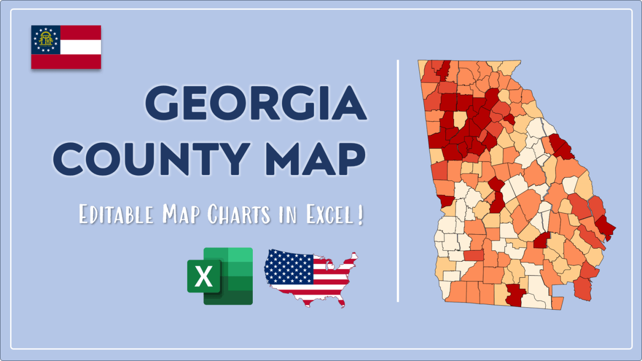
We have built the easiest Georgia Heat Map Maker in the universe! It works fully in Excel:
Here is a list of useful links which we think can be helpful whether you work on data visualization or make research about Georgia state and Georgia counties.
Data Source for Population and many other US related data:
https://www.census.gov
Wikipedia Page for List of Georgia Counties:
https://en.wikipedia.org/wiki/List_of_counties_in_Georgia
Official Website of the State of Georgia:
https://www.georgia.gov
Are you looking for Georgia Zip Code map?:
Georgia Zip Code Heat Map Generator in Excel

