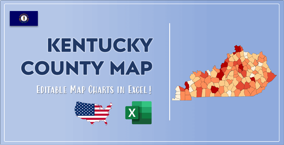

The US state Kentucky (KY) is the 26th largest state by population and 37th biggest state by area. Kentucky has 120 counties ranking it the 4th state with the most counties in USA. See below some basic information about the state:
| Country: | United States |
| State: | Kentucky |
| Abbreviation: | KY |
| Capital: | Frankfort |
| Largest City: | Louisville |
| Population: | 4,467,673 |
| Population rank in US: | 26th |
| Total Area [mi²]: | 40,408 |
| Total Area [km²]: | 104,659 |
| Area rank in US: | 37th |
| Number of Counties: | 120 |
If you want to show data distributon per geographical area, density maps (or heat maps) are a great way to achieve this. For example, here is a Kentucky Population Density Map per County:
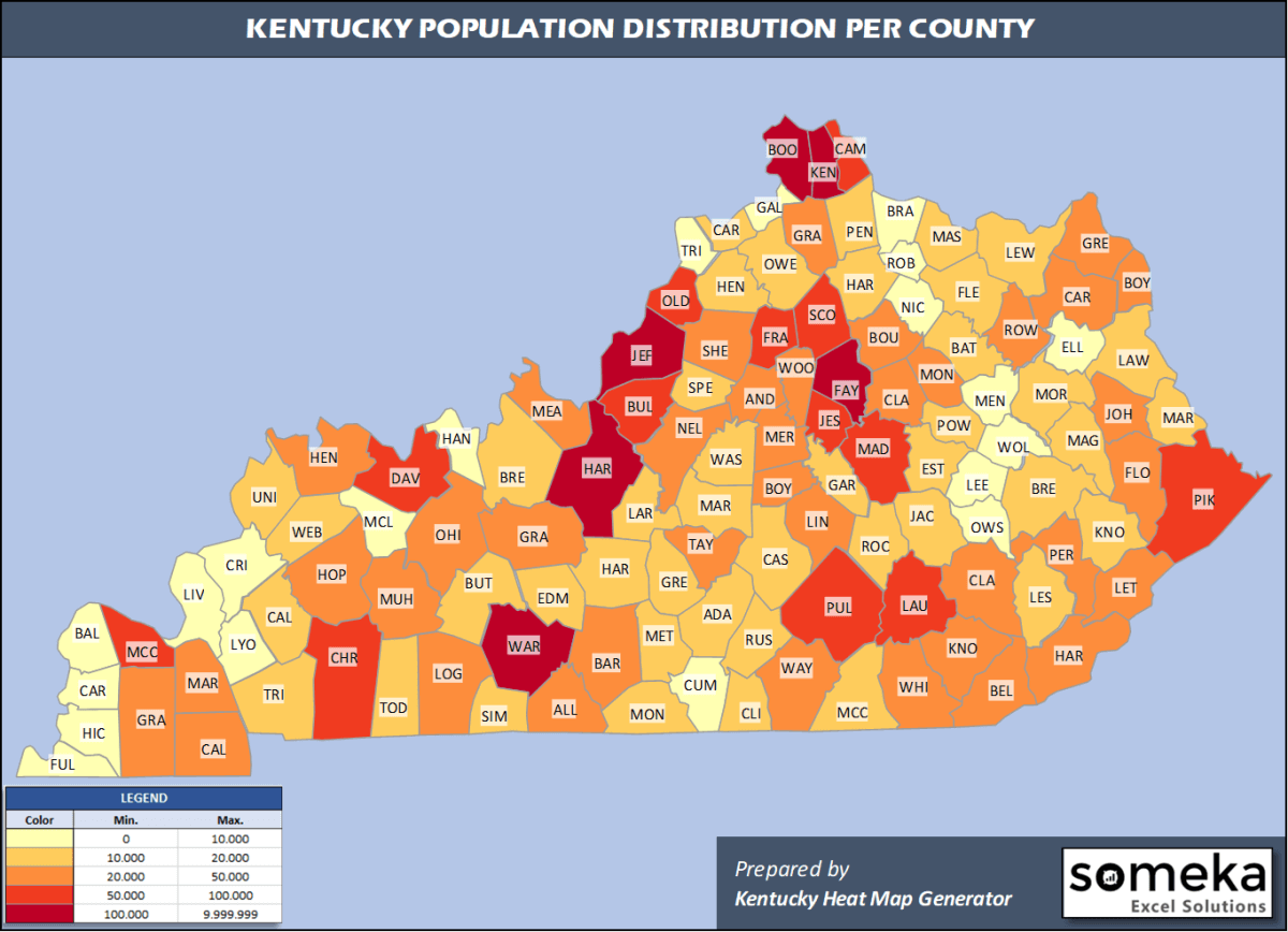
We have prepared this easily with Kentucky County Heat Map Generator for population info. But it can also be used for many different data types such as employment rate, average temperature, racial distribution and so on.
Below are 120 Kentucky counties ranked by population information. The data is from the US Census Bureau. You can copy and paste this list directly into your spreadsheet.
(Top 10 counties shown. To expand the list, simply click on the “show more” button)
| Rank | County | Population |
|---|---|---|
| 1 | Jefferson County | 766,757 |
| 2 | Fayette County | 323,152 |
| 3 | Kenton County | 166,998 |
| 4 | Boone County | 133,581 |
| 5 | Warren County | 132,896 |
| 6 | Hardin County | 110,958 |
| 7 | Daviess County | 101,511 |
| 8 | Campbell County | 93,584 |
| 9 | Madison County | 92,987 |
| 10 | Bullitt County | 81,676 |
| 11 | Christian County | 70,461 |
| 12 | Oldham County | 66,799 |
| 13 | McCracken County | 65,418 |
| 14 | Pulaski County | 64,979 |
| 15 | Laurel County | 60,813 |
| 16 | Pike County | 57,876 |
| 17 | Scott County | 57,004 |
| 18 | Jessamine County | 54,115 |
| 19 | Franklin County | 50,991 |
| 20 | Shelby County | 49,024 |
| 21 | Boyd County | 46,718 |
| 22 | Nelson County | 46,233 |
| 23 | Henderson County | 45,210 |
| 24 | Hopkins County | 44,686 |
| 25 | Barren County | 44,249 |
| 26 | Calloway County | 39,001 |
| 27 | Graves County | 37,266 |
| 28 | Whitley County | 36,264 |
| 29 | Clark County | 36,263 |
| 30 | Floyd County | 35,589 |
| 31 | Greenup County | 35,098 |
| 32 | Knox County | 31,145 |
| 33 | Marshall County | 31,100 |
| 34 | Muhlenberg County | 30,622 |
| 35 | Boyle County | 30,060 |
| 36 | Meade County | 28,572 |
| 37 | Montgomery County | 28,157 |
| 38 | Logan County | 27,102 |
| 39 | Carter County | 26,797 |
| 40 | Woodford County | 26,734 |
| 41 | Grayson County | 26,427 |
| 42 | Bell County | 26,032 |
| 43 | Harlan County | 26,010 |
| 44 | Taylor County | 25,769 |
| 45 | Perry County | 25,758 |
| 46 | Grant County | 25,069 |
| 47 | Lincoln County | 24,549 |
| 48 | Rowan County | 24,460 |
| 49 | Ohio County | 23,994 |
| 50 | Anderson County | 22,747 |
| 51 | Johnson County | 22,188 |
| 52 | Mercer County | 21,933 |
| 53 | Letcher County | 21,553 |
| 54 | Allen County | 21,315 |
| 55 | Breckinridge County | 20,477 |
| 56 | Wayne County | 20,333 |
| 57 | Clay County | 19,901 |
| 58 | Bourbon County | 19,788 |
| 59 | Spencer County | 19,351 |
| 60 | Marion County | 19,273 |
| 61 | Adair County | 19,202 |
| 62 | Hart County | 19,035 |
| 63 | Harrison County | 18,886 |
| 64 | Simpson County | 18,572 |
| 65 | Russell County | 17,923 |
| 66 | Garrard County | 17,666 |
| 67 | McCreary County | 17,231 |
| 68 | Mason County | 17,070 |
| 69 | Rockcastle County | 16,695 |
| 70 | Casey County | 16,159 |
| 71 | Henry County | 16,126 |
| 72 | Lawrence County | 15,317 |
| 73 | Knott County | 14,806 |
| 74 | Trigg County | 14,651 |
| 75 | Pendleton County | 14,590 |
| 76 | Fleming County | 14,581 |
| 77 | Larue County | 14,398 |
| 78 | Union County | 14,381 |
| 79 | Estill County | 14,106 |
| 80 | Jackson County | 13,329 |
| 81 | Morgan County | 13,309 |
| 82 | Lewis County | 13,275 |
| 83 | Webster County | 12,942 |
| 84 | Butler County | 12,879 |
| 85 | Caldwell County | 12,747 |
| 86 | Breathitt County | 12,630 |
| 87 | Bath County | 12,500 |
| 88 | Powell County | 12,359 |
| 89 | Todd County | 12,294 |
| 90 | Magoffin County | 12,161 |
| 91 | Edmonson County | 12,150 |
| 92 | Washington County | 12,095 |
| 93 | Martin County | 11,195 |
| 94 | Green County | 10,941 |
| 95 | Owen County | 10,901 |
| 96 | Monroe County | 10,650 |
| 97 | Carroll County | 10,631 |
| 98 | Clinton County | 10,218 |
| 99 | Metcalfe County | 10,071 |
| 100 | Leslie County | 9,877 |
| 101 | McLean County | 9,207 |
| 102 | Livingston County | 9,194 |
| 103 | Gallatin County | 8,869 |
| 104 | Crittenden County | 8,806 |
| 105 | Hancock County | 8,722 |
| 106 | Trimble County | 8,471 |
| 107 | Bracken County | 8,303 |
| 108 | Lyon County | 8,210 |
| 109 | Ballard County | 7,888 |
| 110 | Elliott County | 7,517 |
| 111 | Lee County | 7,403 |
| 112 | Nicholas County | 7,269 |
| 113 | Wolfe County | 7,157 |
| 114 | Cumberland County | 6,614 |
| 115 | Menifee County | 6,489 |
| 116 | Fulton County | 5,969 |
| 117 | Carlisle County | 4,760 |
| 118 | Owsley County | 4,415 |
| 119 | Hickman County | 4,380 |
| 120 | Robertson County | 2,108 |
Out of the 120 counties in Kentucky, Jefferson County is the largest by population. Pike County is the largest by land area.
Robertson County is the smallest Kentucky county by population. Gallatin County is the smallest by size.
In terms of economics and average income level, Oldham County is the richest Kentucky county.
Pawnee County is the poorest Kentucky county.
We have prepared Kentucky county density map by population as a downloadable PDF.
You can download the PDF for free from the link below:

Kentucky County Density Map PDF
Check the video below to see how we use our Kentucky County Map Excel Template to visualize any data over Kentucky counties.
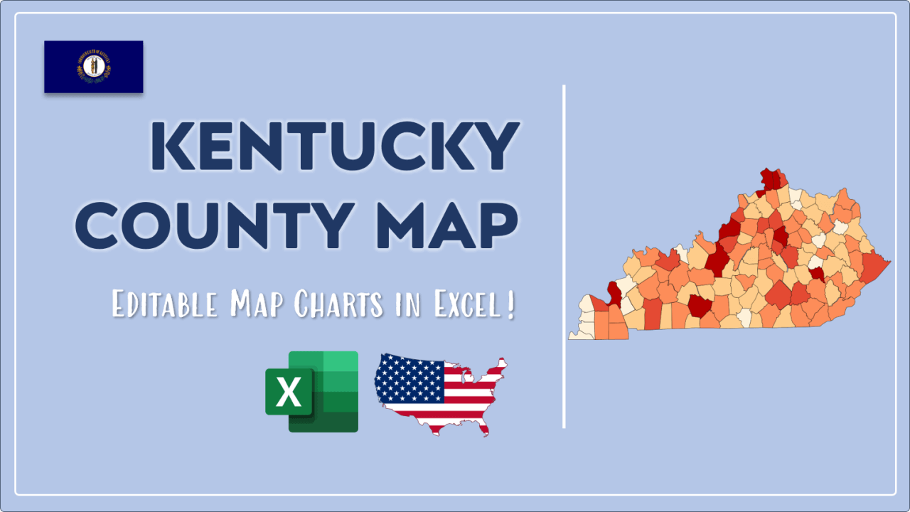
We have built the easiest Kentucky Heat Map Maker in the universe! It works fully in Excel:
Here is a list of useful links which we think can be helpful whether you work on data visualization or make research about Kentucky state and Kentucky counties.
Data Source for Population and many other US related data:
https://www.census.gov
Wikipedia Page for List of Kentucky Counties:
https://en.wikipedia.org/wiki/List_of_counties_in_Kentucky
Official Website of the State of Kentucky:
https://www.kentucky.gov
Are you looking for Kentucky Zip Code map?:
Kentucky Zip Code Heat Map Generator in Excel

