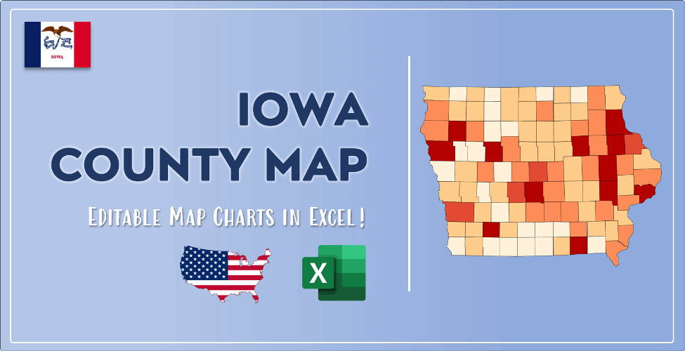

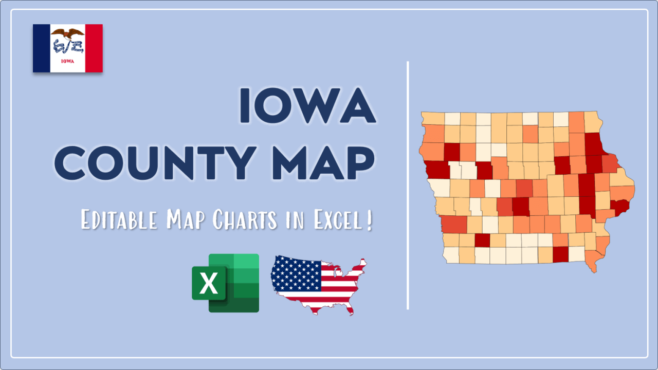
The US state Iowa (IA) is the 31st largest state by population and 26th biggest state by area. Iowa has 99 counties ranking it the 9th state with the most counties in USA. See below some basic information about the state:
| Country: | United States |
| State: | Iowa |
| Abbreviation: | IA |
| Capital: | Des Moines |
| Largest City: | Des Moines |
| Population: | 3,155,070 |
| Population rank in US: | 31st |
| Total Area [mi²]: | 56,271 |
| Total Area [km²]: | 145,750 |
| Area rank in US: | 26th |
| Number of Counties: | 99 |
If you want to show data distributon per geographical area, density maps (or heat maps) are a great way to achieve this. For example, here is a Iowa Population Density Map per County:
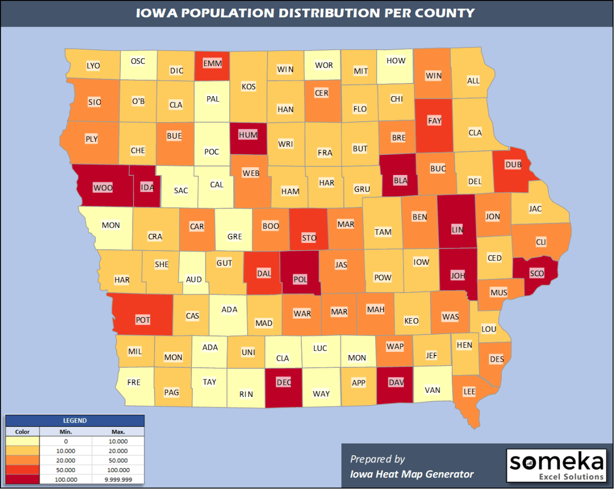
We have prepared this easily with Iowa County Heat Map Generator for population info. But it can also be used for many different data types such as employment rate, average temperature, racial distribution and so on.
Below are 99 Iowa counties ranked by population information. The data is from the US Census Bureau. You can copy and paste this list directly into your spreadsheet.
(Top 10 counties shown. To expand the list, simply click on the “show more” button)
| Rank | County | Population |
|---|---|---|
| 1 | Polk County | 490,161 |
| 2 | Linn County | 226,706 |
| 3 | Scott County | 172,943 |
| 4 | Johnson County | 151,140 |
| 5 | Black Hawk County | 131,228 |
| 6 | Woodbury County | 103,107 |
| 7 | Dubuque County | 97,311 |
| 8 | Story County | 97,117 |
| 9 | Dallas County | 93,453 |
| 10 | Pottawattamie County | 93,206 |
| 11 | Warren County | 51,466 |
| 12 | Clinton County | 46,429 |
| 13 | Muscatine County | 42,664 |
| 14 | Cerro Gordo County | 42,450 |
| 15 | Marshall County | 39,369 |
| 16 | Des Moines County | 38,967 |
| 17 | Jasper County | 37,185 |
| 18 | Webster County | 35,904 |
| 19 | Wapello County | 34,969 |
| 20 | Sioux County | 34,855 |
| 21 | Lee County | 33,657 |
| 22 | Marion County | 33,253 |
| 23 | Boone County | 26,234 |
| 24 | Benton County | 25,645 |
| 25 | Plymouth County | 25,177 |
| 26 | Bremer County | 25,062 |
| 27 | Mahaska County | 22,095 |
| 28 | Washington County | 21,965 |
| 29 | Buchanan County | 21,175 |
| 30 | Jones County | 20,681 |
| 31 | Carroll County | 20,165 |
| 32 | Winneshiek County | 19,991 |
| 33 | Henry County | 19,954 |
| 34 | Fayette County | 19,650 |
| 35 | Buena Vista County | 19,620 |
| 36 | Jackson County | 19,439 |
| 37 | Cedar County | 18,627 |
| 38 | Poweshiek County | 18,504 |
| 39 | Jefferson County | 18,295 |
| 40 | Clayton County | 17,549 |
| 41 | Dickinson County | 17,258 |
| 42 | Delaware County | 17,011 |
| 43 | Tama County | 16,854 |
| 44 | Hardin County | 16,846 |
| 45 | Crawford County | 16,820 |
| 46 | Madison County | 16,338 |
| 47 | Iowa County | 16,184 |
| 48 | Clay County | 16,016 |
| 49 | Floyd County | 15,642 |
| 50 | Mills County | 15,109 |
| 51 | Page County | 15,107 |
| 52 | Kossuth County | 14,813 |
| 53 | Hamilton County | 14,773 |
| 54 | Butler County | 14,439 |
| 55 | Harrison County | 14,049 |
| 56 | O'Brien County | 13,753 |
| 57 | Allamakee County | 13,687 |
| 58 | Cass County | 12,836 |
| 59 | Wright County | 12,562 |
| 60 | Appanoose County | 12,426 |
| 61 | Union County | 12,241 |
| 62 | Grundy County | 12,232 |
| 63 | Chickasaw County | 11,933 |
| 64 | Lyon County | 11,755 |
| 65 | Shelby County | 11,454 |
| 66 | Cherokee County | 11,235 |
| 67 | Louisa County | 11,035 |
| 68 | Guthrie County | 10,689 |
| 69 | Hancock County | 10,630 |
| 70 | Mitchell County | 10,586 |
| 71 | Winnebago County | 10,354 |
| 72 | Keokuk County | 10,246 |
| 73 | Franklin County | 10,070 |
| 74 | Montgomery County | 9,917 |
| 75 | Sac County | 9,721 |
| 76 | Calhoun County | 9,668 |
| 77 | Humboldt County | 9,558 |
| 78 | Clarke County | 9,395 |
| 79 | Emmet County | 9,208 |
| 80 | Howard County | 9,158 |
| 81 | Davis County | 9,000 |
| 82 | Greene County | 8,888 |
| 83 | Palo Alto County | 8,886 |
| 84 | Monona County | 8,615 |
| 85 | Lucas County | 8,600 |
| 86 | Decatur County | 7,870 |
| 87 | Monroe County | 7,707 |
| 88 | Worth County | 7,381 |
| 89 | Adair County | 7,152 |
| 90 | Van Buren County | 7,044 |
| 91 | Fremont County | 6,960 |
| 92 | Ida County | 6,860 |
| 93 | Pocahontas County | 6,619 |
| 94 | Wayne County | 6,441 |
| 95 | Taylor County | 6,121 |
| 96 | Osceola County | 5,958 |
| 97 | Audubon County | 5,496 |
| 98 | Ringgold County | 4,894 |
| 99 | Adams County | 3,602 |
Out of the 99 counties in Iowa, Polk County is the largest by population. Kossuth County is the largest by land area.
Adams County is the smallest Iowa county by population. Dickinson County is the smallest by size.
In terms of economics and average income level, Dallas County is the richest Iowa county.
Decatur County is the poorest Iowa county.
We have prepared Iowa county density map by population as a downloadable PDF.
You can download the PDF for free from the link below:

Iowa County Density Map PDF
Check the video below to see how we use our Iowa County Map Excel Template to visualize any data over Iowa counties.
We have built the easiest Iowa Heat Map Maker in the universe! It works fully in Excel:
Here is a list of useful links which we think can be helpful whether you work on data visualization or make research about Iowa state and Iowa counties.
Data Source for Population and many other US related data:
https://www.census.gov
Wikipedia Page for List of Iowa Counties:
https://en.wikipedia.org/wiki/List_of_counties_in_Iowa
Official Website of the State of Iowa:
https://www.iowa.gov
Are you looking for Iowa Zip Code map?:
Iowa Zip Code Heat Map Generator in Excel

